One of the challenges of the MetAlp project is to develop a meteorological model, capable of achieving a high spatial resolution to predict the weather in the mountains accurately.
The most frequent visitors to the mountains know that the weather changes quickly, and from a sunny day, it turns into a violent thunderstorm in a few hours. Meteorologists, on the other hand, are aware of the limitations of the forecasting models, the reduced ability to predict very local events, or the greater uncertainty in predicting their intensity and duration. The main reason is related to the discretization of the atmosphere that models are forced to do, as well as the equation approximation that describes the atmosphere.

Currently, the weather models used by forecasting centres, such as ARPA Piemonte, Meteo Swiss, or others, have a grid pitch of at most one kilometre. In mountainous terrain this can be too little, that is, not to represent in detail the topography and the arrangement of the valleys. Current research with regional-scale models aims to improve both the spatial resolution and the physics that describes the atmosphere (equations) contained in the models.
Much is being done in the meteorological community to improve and understand more deeply the lowest layer of the atmosphere, which is in contact with the Earth's surface: the boundary layer (or the Planetary Boundary Layer).
In mountainous terrain, the boundary layer presents complexities which on horizontal, homogeneous and flat terrain does not exist. The current theory that describes the turbulence of the PBL, dated 1950s, has been seen to provide equations with hypotheses that in mountain terrain (therefore not horizontal, not homogeneous and not flat) prove to be no longer valid.
Great efforts are being made to, first of all, understand what happens in the mountain PBL (or Mountain Boundary Layer), through experiments and measurement campaigns, and then trying to describe with the new theories, or adaptations of the old, the dynamics of the atmosphere.
The MetAlp project is located halfway, applying current knowledge, and testing new modelling techniques wants to develop a weather model that can best simulate atmospheric dynamics in complex terrain and with high spatial resolution.
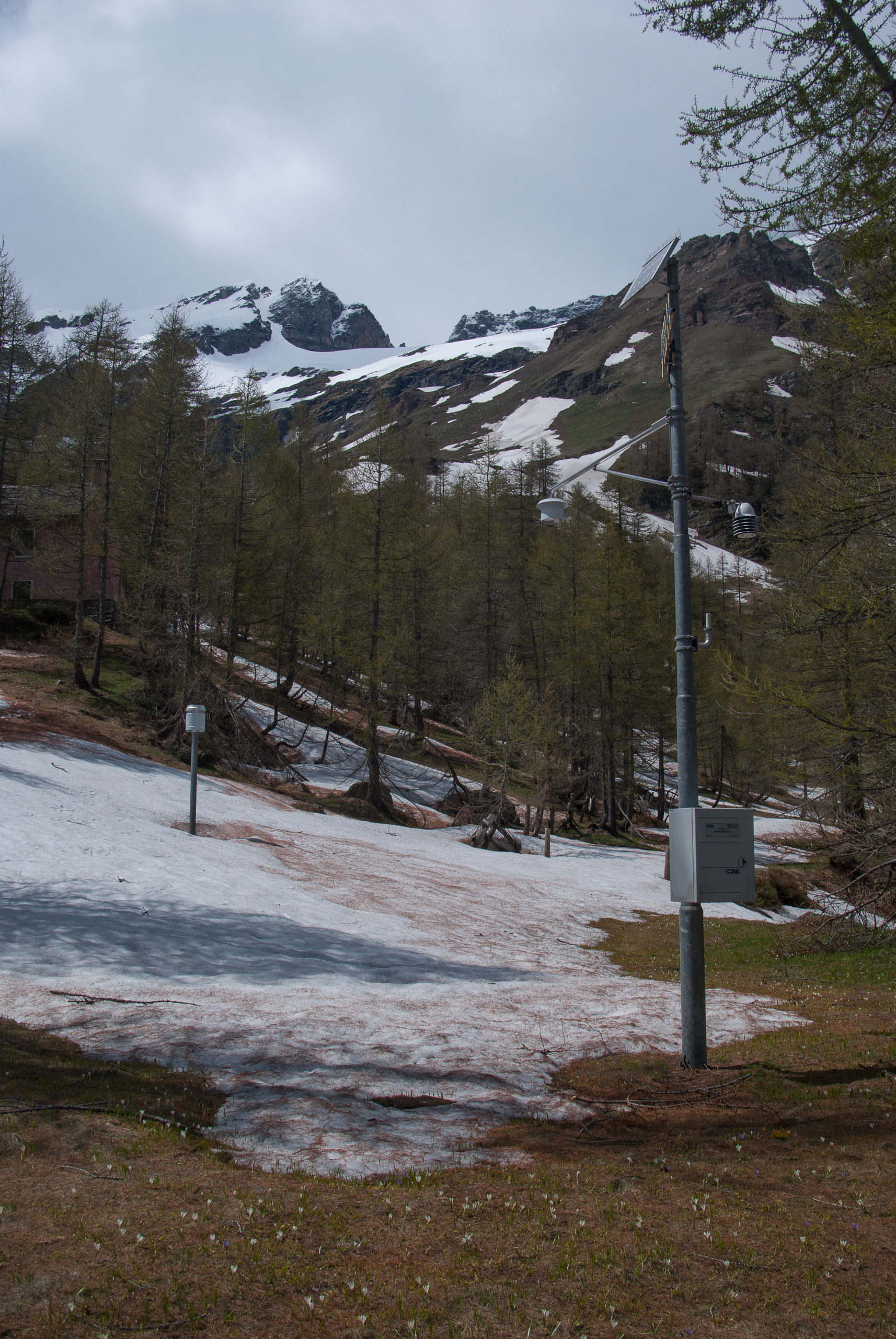
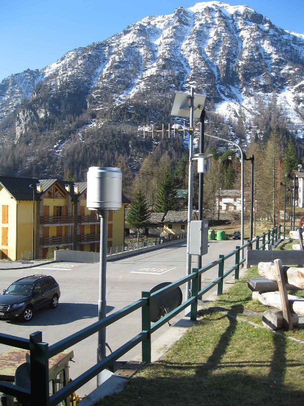
To do this, it is necessary to use several case studies, and above all data measured on-site.
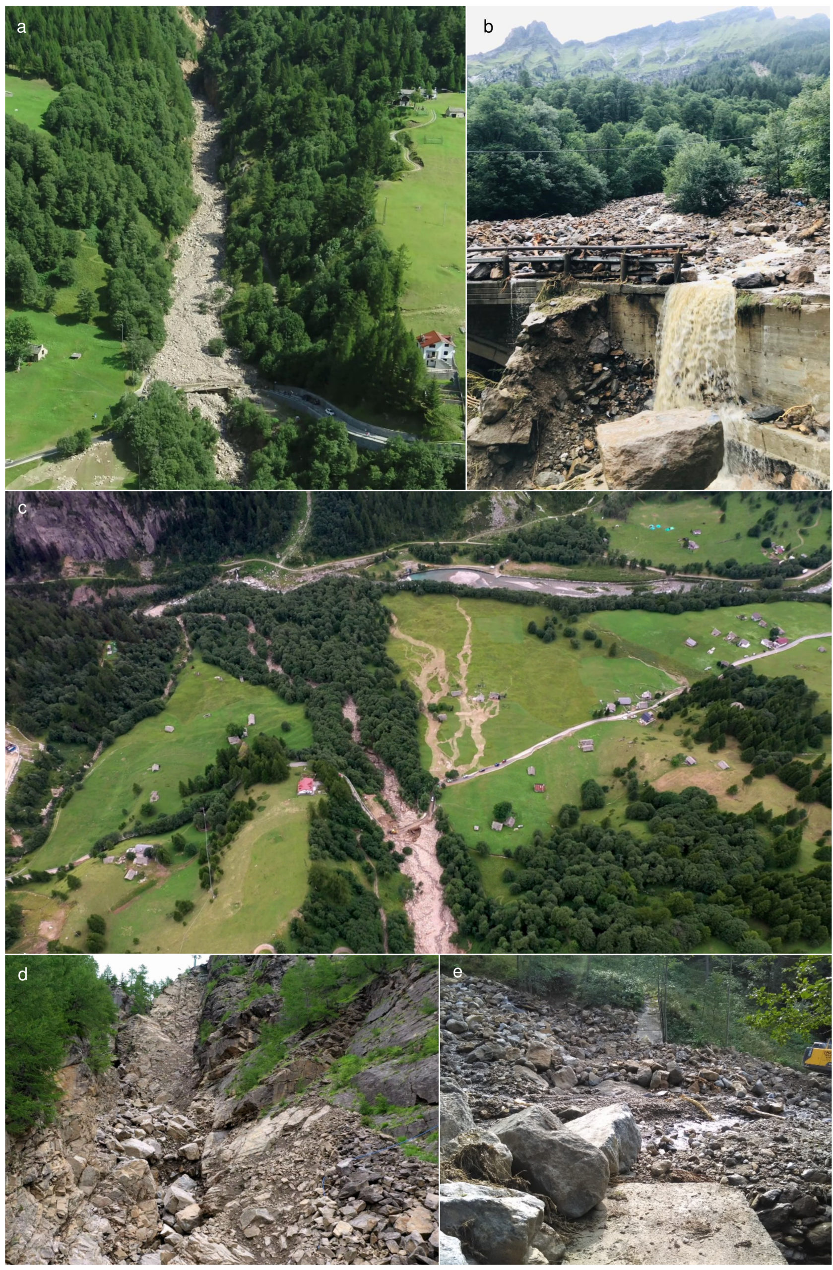
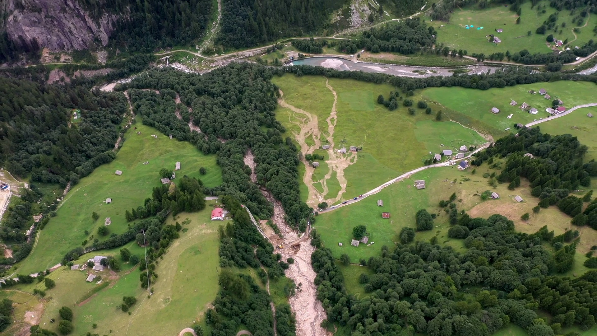
This first study, published in Applied Sciences Journal, considers a very intense precipitation event that reactivated a landslide in the bed of the Croso stream, which was quiescent from the Piedmont flood of October 2000. The debris flow blocked the road leading from San Domenico to Ponte Campo and Alpe Veglia. The estimate of the material accumulated at the foot of the landslide is 37759 cubic meters.

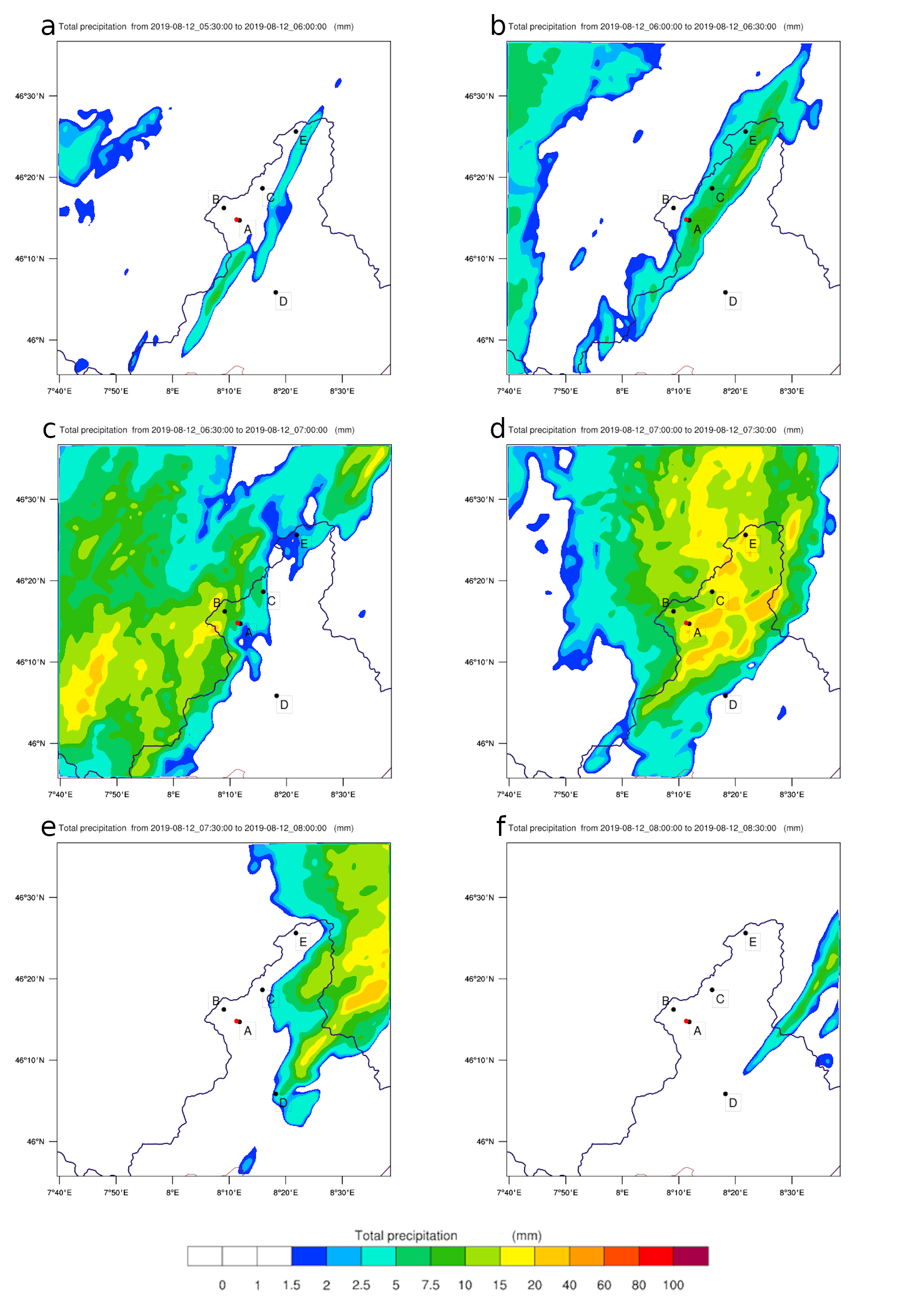
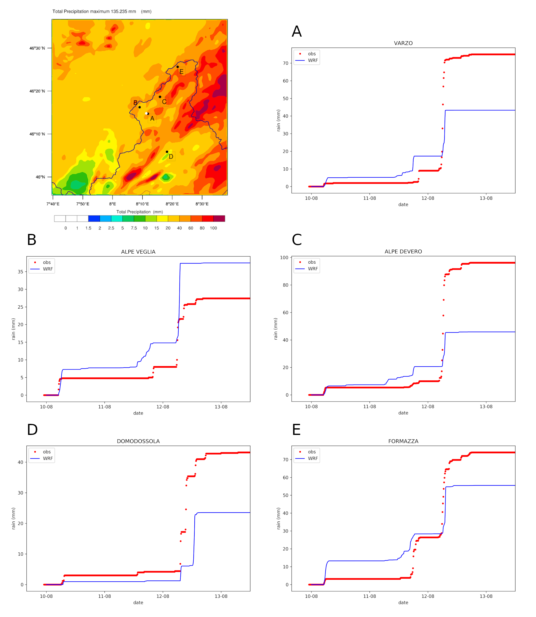
The WRF model was applied to this case study. The chosen horizontal resolution was 500 meters, and the vertical levels near the ground were thickened (inside the boundary layer). In this case, the accuracy of predicting turbulent parameters was not assessed, but only the Authors focused on precipitation. It should be remembered, however, that the precipitation forecast is precise if the model interprets and calculates all the other parameters correctly, especially those related to convection and turbulence.
In August 2019, the model partially underestimated the amount of precipitation, while the timing was captured with high precision.
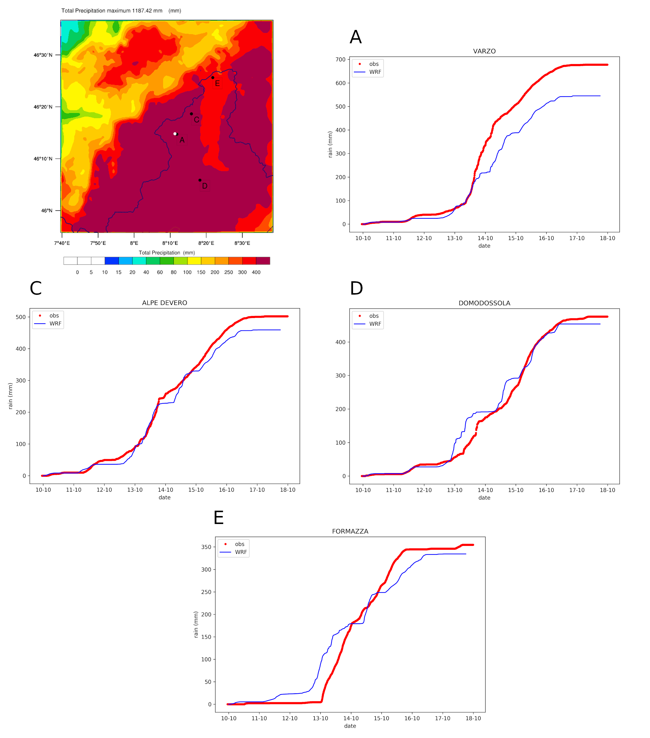
In parallel with this event, the Authors also studied the October 2000 event that caused a debris flow in the Rio Croso basin. In this case, the precipitation was predicted with more accuracy and with a lower underestimation.
The article
Weather Simulation of Extreme Precipitation Events Inducing Slope Instability Processes over Mountain Landscapes
Authors: Alessio Golzio, Irene Maria Bollati, Marco Luciani, Manuela Pelfini, Silvia Ferrarese
Abstract
Mountain landscapes are characterised by a very variable environment under different points of view (topography, geology, meteorological conditions), and they are frequently affected by mass wasting processes. A debris flow that occurred along the Croso stream, located in the Italian Lepontine Alps in the Northern Ossola Valley, during summer 2019, was analysed from a geological/geomorphological and meteorological point of view. The debris flow was triggered by an intense precipitation event that heavily impacted a very restricted area over the course of three hours. A previous debris flow along the same stream occurred in Autumn 2000, but it was related to an intense and prolonged rainfall event. The slope was characterised in terms of sediment connectivity, and data were retrieved and elaborated from the Web-GIS (Web-Geographic Information System) database of the IFFI-Italian Landslide Inventory and historical archives of landslides. Both the events were analysed through the weather research and forecasting (WRF) model applying a very high horizontal grid spacing with the aim of catching the precipitation patterns and timings. The obtained results are compared with the observed precipitation at a selection of weather stations in the area. The simulation of WRF that measured the timing in total precipitation and in its minor steps could be considered reliable. Moreover, it reveals to be appropriate for detecting in advance the meteorological conditions potentially triggering mass-wasting processes affecting slopes featuring high connectivity conditions and lithotypes characterised by a high Landslide Susceptibility Index.


0 Comments
You must log in to post a comment.